Galapagos main page - west - north and northeast - center - southeast
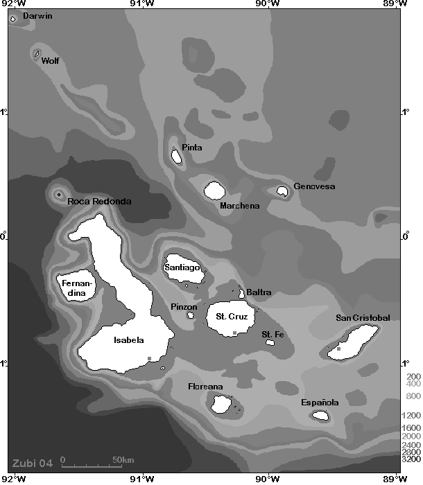
Map: Overview Galapagos islands. Bathymetric map 0-200m / 200-400m
/ then 400m-contour intervals to 3200m below sea
level
Übersichts-Karte von den Galapagos Inseln. Meereskarte 0-200m / 200-400m
/ dann 400m Abstufungen bis 3200m

Map of the dive sites in the northern Islands of the Galapagos
(Wolf and Darwin)
Karte der Tauchplätze im Norden der Galapagos Inseln (Wolf und Darwin)

Map of the dive sites in the north-eastern Islands of the Galapagos
(Pinta, Marchena, Genovesa)
Karte der Tauchplätze im Nordosten der Galapagos Inseln (Pinta, Marchena,
Genovesa)
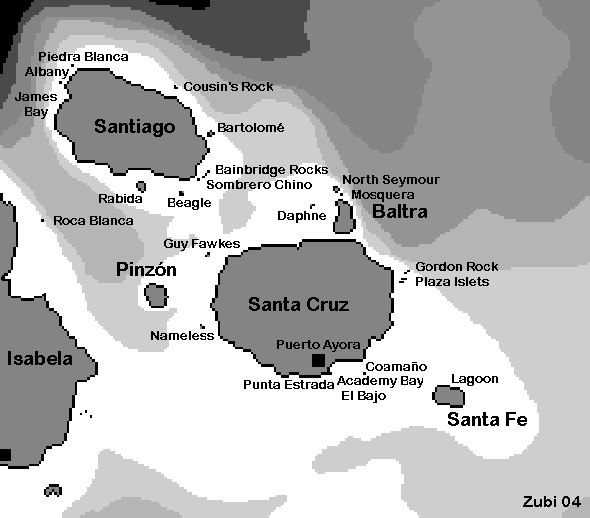
Map of the dive sites in the central Islands of the Galapagos
(Santa Cruz, Santa Fe, Santiago)
Karte der Tauchplätze im Zentrum der Galapagos Inseln (Santa Cruz, Santa
Fe, Santiago)
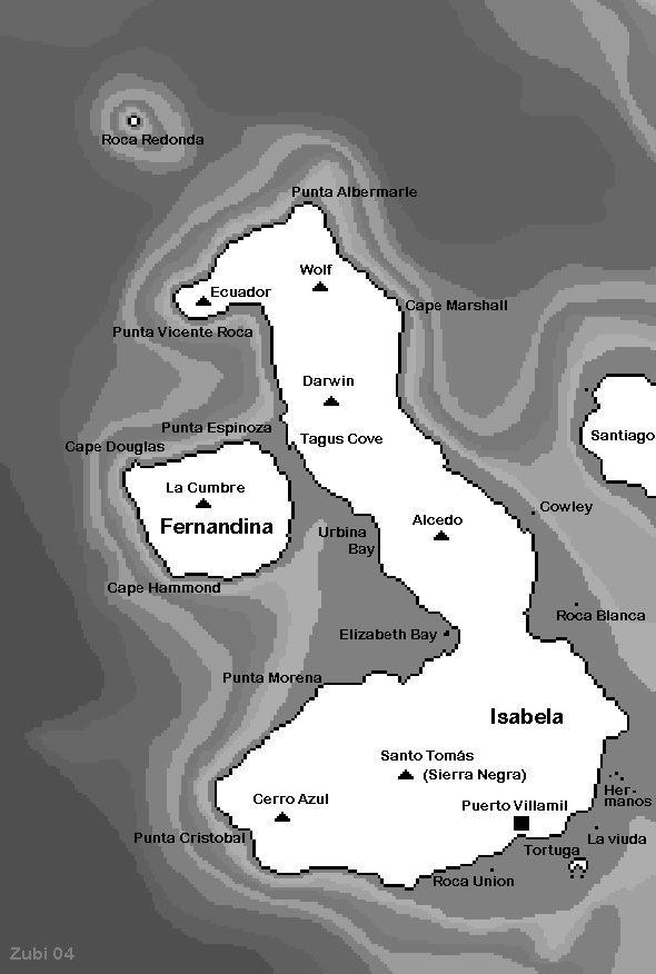
Map of the dive sites in the western Islands of the Galapagos
(Isabela and Fernandina)
Karte der Tauchplätze im Westen der Galapagos Inseln (Isabela und Fernandina)
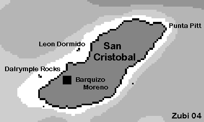
Map of the dive sites in the eastern Islands of the Galapagos
(San Cristobal)
Karte der Tauchplätze im Osten der Galapagos Inseln (San Cristobal)
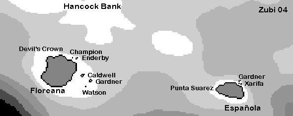
Map of the dive sites in the southern Islands of the Galapagos (Floreana. Espanola)
Karte der Tauchplätze im Süden der Galapagos Inseln (Floreana. Espanola)
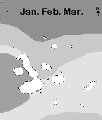
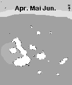
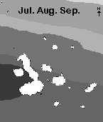
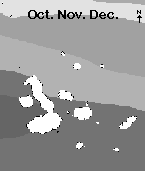
Sea-surface temperatures (SST) in the Galapagos from January to December
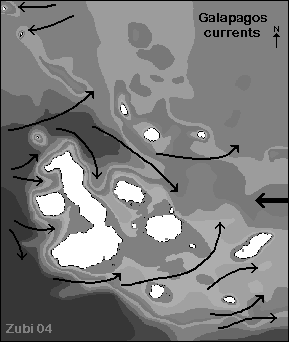
Map of ocean currents in the Galapagos after Houvenaghel 1978